Leen Helmink Antique Maps
Early impressionist oil painting of Batavia
Stock number: 19927
Zoom ImageCartographer(s)
Monogrammist "MvK"
Title
Batavia
First Published
Batavia, 1800
Size
14 x 22 cms
Technique
Condition
excellent
Price
$ 1,250.00
(Convert price to other currencies)
Description
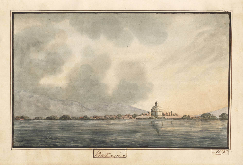
View of Batavia from the roadstead, with the dome of the Nieuwe Hollandsche Kerk
Dutch, late 18th or early 19th century (before 1808)
Watercolour and pen with brown ink, pasted on [laid/wove] paper, within a double-ruled ink border; captioned "Batavia" in pen within a drawn cartouche below the image; monogrammed in ink lower right; numbered 39 in the lower right corner of the sheet.
An album sheet showing the profile of Batavia as seen from the sea: a low, wooded shoreline with warehouses and red-tiled roofs, dominated at right of centre by the ribbed dome and lantern of the Nieuwe Hollandsche Kerk (the "Koepelkerk," consecrated 1736), with a smaller tower beside it. Calm water with the mirrored reflection of the dome. Behind the town rise the mountains of the Priangan hinterland (the Salak and Gede–Pangrango ranges, the "Blue Mountains" of contemporary travellers).
The dome of the Koepelkerk, which rose high enough above the town to serve mariners as a landfall beacon, provides a terminus ante quem for the composition: the church was demolished under Governor-General Daendels around 1808, and no dome appeared on the Batavia skyline again until the Willemskerk at Weltevreden (1830s), invisible from the roadstead. The sheet belongs to the tradition of watercolour port-view series, produced for travellers' and family albums on the Indies route from the later eighteenth century onward.
Rarity
Early watercolours of Batavia are exceptionally rare on the market.
Condition description
Excellent.
Related Categories
Related Items