Leen Helmink Antique Maps
Antique map of Australia, New Zealand and Antarctica by Buache

Stock number: 19863
Zoom ImageCartographer(s)
Buache
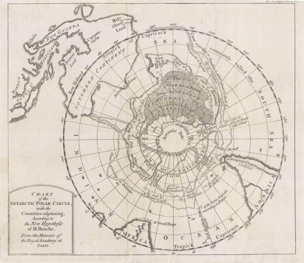
Title
CHART of the ANTARCTIC POLAR CIRCLE, with the Countries adjoining, According to the New Hypothesis of M. Buache. From the Memoirs of the Royal Accademy at PARIS.
First Published
Paris, 1763
Size
19.x x 22.1 cms
Technique
Condition
excellent
Price
$ 350.00
(Convert price to other currencies)
Description
Very unusual map of Antarctica showing New Guinea and Tasmania as parts of Australia; and New Zealand as part of the Antarctic Continent.
Published by D. Henry & R. Cane,
St. John's Gate, London 1763.
Related Categories
Related Items


