Leen Helmink Antique Maps & Atlases
www.helmink.com
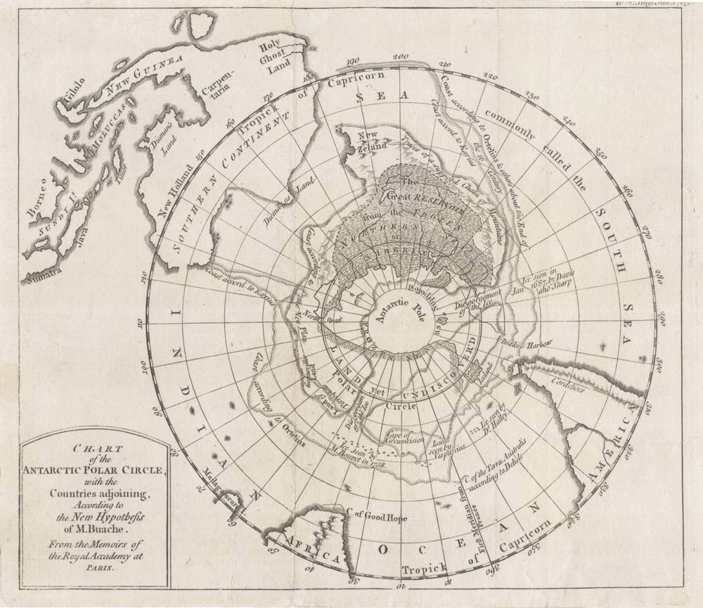
Buache
CHART of the ANTARCTIC POLAR CIRCLE, with the Countries adjoining, According ...
Certificate of Authentication and Description
This is to certify that the item illustrated and described below is a genuine antique
map, print or book that was first produced and published in 1763, today 263 years ago.
July 26, 2026
Cartographer(s)
Buache
First Published
Paris, 1763
This edition
Size
19.x x 22.1 cms
Technique
Copper engraving
Stock number
19863
Condition
excellent
Description
Very unusual map of Antarctica showing New Guinea and Tasmania as parts of Australia; and New Zealand as part of the Antarctic Continent.
Published by D. Henry & R. Cane,
St. John's Gate, London 1763.