Leen Helmink Antique Maps
Wall map city views
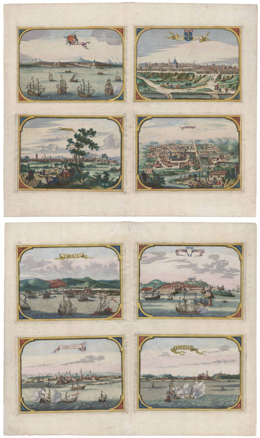
from Visscher's wall maps of Asia and Africa
Eight views
Uncut and in attractive original colour

Stock number: 19855
Zoom ImageCartographer(s)
Nicolaes Visscher II (biography)
Title
BATAVIA
IERVSALEM
KAUTSIU
KOM
THUNIS
TANGERE
TRIPOLI De Barbaria.
DEL MINA
First Published
Amsterdam, 1680
Technique
Condition
mint
Price
$ 3,250.00
(Convert price to other currencies)
Description
Pristine set of total eight city views from Visscher's wall maps of Asia and Africa
Four city views from Visscher's wall map of Asia
Uncut, on one sheet, stunning original colour:
[1] BATAVIA
[2] IERVSALEM
[3] KAUTSIU
[4] KOM
Four city views from Visscher's wall map of Africa
Uncut, on one sheet, stunning original colour:
[1] THUNIS
[2] TANGERE
[3] TRIPOLI De Barbaria.
[4] DEL MINA
Rarity
This is the only known example of these city views, other than the imperfect segments mounted on the few surviving copies of the wall map. The views are lacking in all collections of early city views, even the foremost ones.
Seventeenth century Amsterdam book and map sellers had a very efficient and effective distribution system to sell their books and maps all over Europe. They would exhibit their products at the yearly bookfair in Franfurt, where colleague book and map sellers would put in sizeable orders that would mostly be shipped to them after the fair, over land or by sea (depending oon the destination), to Scandinavia, to Italy, Germany, France, Britain, Eastern Europe and so on. These buyers would then resell the products in their city. Wall maps could be ordered in two versions. One version was to order them assembled by the maker (mounted on linen and attached to wooden rollers, colored or uncolored) and shipped rolled in a long wooden crate. Alternatively, cheaper and more popular, they could be ordered as a construction kit, in separate sheet segments (colored or uncolored), with an instruction booklet on how to assemble the sheets and in what order (think Ikea). Separate sheets and loose maps were generally packed in quantity in wooden barrels, like books were, to facilitate easy handling of the considerable weight of paper.
As expected, loose segments of wall maps have a much greater chance of surviving the damages of time to assembled wall maps, and they are often the only examples of what a wall map would have looked like in pristine condition. It was however irresistable for the resellers or the end customers to assemble them, thus fast-tracking their demise. It is therefore that loose segments of wall maps are even rarer than assembled wall maps.
Not in any collection of views of Jerusalem, Middle East, Gulf States, Macao, Moluccas, Portuguese India, Indian Ocean or VOC.
Claes Janszoon Visscher 1587-1652
Nicolaes Visscher I (son) 1618-1679
Nicolaes Visscher II (grandson) 1649-1702
Elisabeth Visscher (widow of N. Visscher II)
"For nearly a century the members of the Visscher family were important art dealers and map publishers in Amsterdam. The founder of the business, Claes Janszoon Visscher, had premises near to those of Pieter van den Keere and Jodocus Hondius whose pupil he may have been.
From about 1620 he designed a number of individual maps, including one of the British Isles, but his first atlas consisted of maps printed from plates bought from van den Keere and issued as they stood with some additions of his own, including historical scenes of battles and sieges for which he had a high reputation.
Some maps bear the latinized form of the family name: Piscator. After Visscher's death his son and grandson, both of the same name, issued a considerable number of atlases, constantly revised and brought up to date but most of them lacking an index and with varying contents.
The widow of Nicholaes Visscher II carried on the business until it finally passed into the hands of Pieter Schenk."
(Moreland & Bannister).
Related Categories
Related Items


