Leen Helmink Antique Maps
Early navigation chart of Port Jackson
The item below has been sold, but if you enter your email address we will notify you in case we have another example that is not yet listed or as soon as we receive another example.

Stock number: 19511
Zoom ImageCartographer(s)
the British Admiralty
Title
Port Jackson
First Published
London, 1890
This Edition
London, 1949
Size
67 x 130 cms
Technique
Condition
mint
Price
This Item is Sold
Description
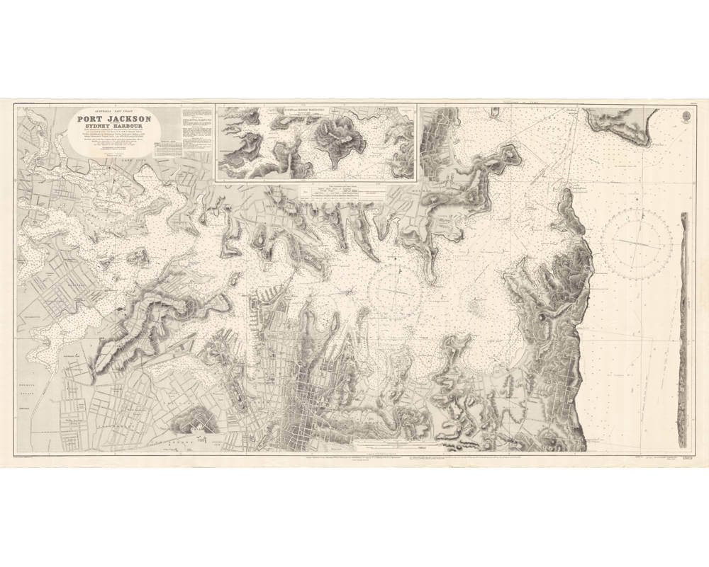
Very large seminal sea chart of Sydney Harbour, printed and used by the British Admiralty based on information by the New South Wales Government, 1887.
First published in 1890 and frequently updated, here in one of the later updates of 1949, meaning this seminal chart was in use for more than half a century.
Australia - east coast, Port Jackson / compiled by Lieutenants T.F. Pullen and G.W. Gubbins, H.M.S. Lark, from information supplied by the New South Wales Government, 1887, and amended by Lieut. J.D. Nares, R.N., H.M.S. Fantome, 1912-13 ; futher amendments by the Sydney Harbour Trust to 1948
Condition
Pristine collector's condition.


