Leen Helmink Antique Maps & Atlases
www.helmink.com
the British Admiralty
Port Jackson
Certificate of Authentication and Description
This is to certify that the item illustrated and described below is a genuine antique
map, print or book that was first produced and published in 1890, today 136 years ago.
July 22, 2026
Cartographer(s)
the British Admiralty
First Published
London, 1890
This edition
London, 1949
Size
67 x 130 cms
Technique
Copper engraving
Stock number
19511
Condition
mint
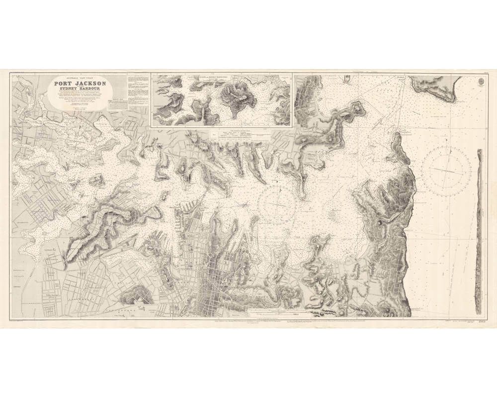
Description
Very large seminal sea chart of Sydney Harbour, printed and used by the British Admiralty based on information by the New South Wales Government, 1887.
First published in 1890 and frequently updated, here in one of the later updates of 1949, meaning this seminal chart was in use for more than half a century.
Australia - east coast, Port Jackson / compiled by Lieutenants T.F. Pullen and G.W. Gubbins, H.M.S. Lark, from information supplied by the New South Wales Government, 1887, and amended by Lieut. J.D. Nares, R.N., H.M.S. Fantome, 1912-13 ; futher amendments by the Sydney Harbour Trust to 1948
Condition
Pristine collector's condition.