Leen Helmink Antique Maps
Old books, maps and prints by Thomas Ham
Thomas Ham (1821 -1870)
Thomas Ham: The Father of Map Publishing in Victoria Australia
Thomas Ham (1821 -1870) was the father of map publishing in Victoria, printing maps in Melbourne well in advance of the Gold Rush. Ham was a native of Devon, England, and immigrated to Melbourne in 1842, arriving with his parents and two brothers. His father soon became an important figure in town as the minister of the Collins Street Baptist Church.
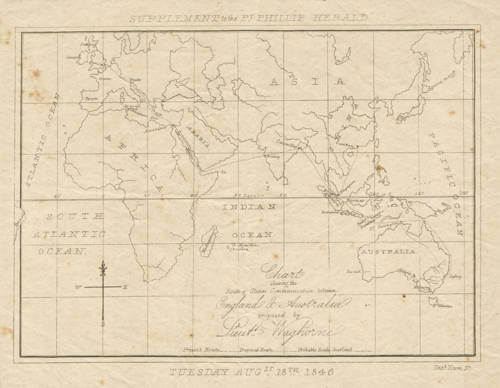
Thomas had apprenticed as an engraver and lithographer in England and showed great natural aptitude for his profession. He benefited greatly from the fact that, during the early 1840s, he was one of the only people in Melbourne with any experience in printing, and so in 1843 he was contracted to engrave the corporation seal for the Town of Melbourne. He soon incorporated a business on Collins Street and became the official government printer in Melbourne, as well as fulfilling commissions from various banks, businesses and periodicals, such as the Port Phillip Herald. Additionally, philatelists value Ham’s work, for he engraved the first Victoria stamps.
Thomas and his brothers showed a great and skilled interest in land speculation and as early as 1845 they held titles to properties in the countryside beyond Melbourne. His contacts in government and in the settler community gave him unrivalled access to the latest geographic intelligence in the region. He realized the urgent need for an accurate and fully up-to-date map of the ‘Port Phillip District’ (later Victoria) and issued a Map of Australia Felix (1847), which was importantly the first locally produced map of the region.
Not unlike the situation in San Francisco, the discovery of gold in Victoria in 1851 led to a a mass influx of people, wealth and talent that fostered a thriving local print industry, as well as a unique and rich visual culture. From 1856, several other mapmakers were established on the Melbourne scene in effort to satiate the cartographic needs of prospectors and land speculators.
Ham’s Squatter’s Map of Victoria, the successor to his Australia Felix, became the seminal map of Victoria of the Gold Rush era. Published in eleven regularly updated editions up to 1864, it was the map of record used by all government officials, settlers, miners and land speculators, who frequently sent suggestions for additions and updates to Ham’s office, which were duly incorporated into subsequent issues.
Ham also issued other maps more focused on Melbourne and its environs, including Melbourne and Geelong Districts (1849), Map of the Suburban Lands of the City of Melbourne (1852) and Plan of the City of Melbourne (1854).
From 1850 to 1852, Thomas, with his brothers, Theophilus and Jabez, also published the Illustrated Australian Magazine, the first illustrated Australian periodical. Thomas also issued important views of the Gold Rush, including Ham’s Five Views of the Gold Fields of Mount Alexander and Ballarat, drawn by D. Tulloch (1852) and the plates within The Diggers Portfolio and The Gold Diggers Portfolio (1854).
In 1853, Ham and his brothers opened a successful real estate firm that became known as C., J. & T. Ham. In 1857, seeking to capitalize on the specific needs of the mining industry, he joined Victorian Geological Survey Office, where he made pioneering geological maps of the region.
In 1860, Ham moved the Brisbane where he became the lithographer and later the Chief Engraver of the Queensland Survey Office. The highlight of his tenure there was his Atlas of the Colony of Queensland (1868). Ham and some business partners also developed sugar plantations on the Albert River. Thomas Ham died at Brisbane on March 8, 1870, highly regarded for his work as a mapmaker and printer and wealthy from his land dealings.
