Leen Helmink Antique Maps & Atlases
www.helmink.com
Linschoten
Iohn Huighen van Linschoten his Discours of Voyages into ye Easte & West ...
Certificate of Authentication and Description
This is to certify that the item illustrated and described below is a genuine antique
map, print or book that was first produced and published in 1598, today 428 years ago.
October 26, 2026
Cartographer(s)
Linschoten
First Published
London, 1598
This edition
1598 first and only edition
Size
cms
Technique
Copper engraving
Stock number
19947
Condition
excellent
Description
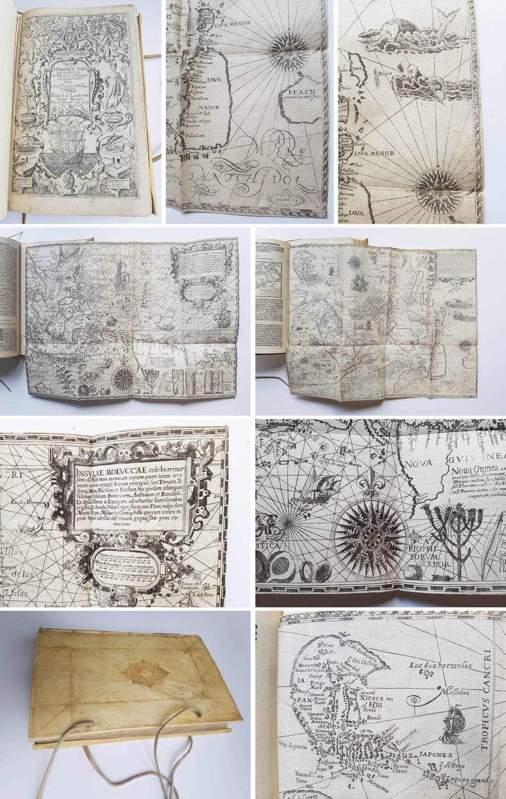
Iohn Huighen van Linschoten his Discours of Voyages into ye Easte & West Indies. Deuided into foure bookes.
London: Printed by [John Windet for] Iohn Wolfe, Printer to the Honourable Cittie of London, [1598].
First edition in English of Jan Huygen van Linschoten’s celebrated Itinerario (Amsterdam, 1595–96), the landmark work that broke the Portuguese monopoly on navigational knowledge of the East Indies and became an indispensable handbook for Dutch and English expansion into Asian trade.
Translated from the Dutch by William Phillip (whose initials “W.P.” appear on the sectional titles of Books 2–4), this is an unauthorized English version produced under the encouragement of Richard Hakluyt. John Wolfe, a printer with a well-earned reputation for opportunistic publishing, issued it swiftly after the Dutch original appeared. The handsome engraved general title is by William Rogers; the maps are newly re-engraved in London (chiefly by Robert Beckit, with additional plates by Rogers and others), carrying bilingual Latin and English captions. Notably, the English edition omits the extensive suite of ethnographic and costume views that illustrated the Amsterdam edition (though sets of the original Dutch plates were occasionally imported and bound into individual copies).
Divided into four books, the work combines Linschoten’s first-hand account of his years in Goa (1583–89) with detailed sailing directions (the Reys-gheschrift), coastal descriptions of West Africa and the Americas, and a summary of Spanish and Portuguese revenues. Its maps, including derivatives of Ortelius’s world map, detailed charts of the coasts of Africa, Arabia, India, Southeast Asia, and the East Indies, provided practical intelligence of unprecedented accuracy for Northern European mariners. Legend holds that copies were issued to Dutch ships bound for the Indies; the English translation performed a comparable service for English enterprise.
A cornerstone of Elizabethan travel literature, second only to Hakluyt’s own collections in influence, and of the highest importance for the history of European expansion, cartography, and the spice trade. Complete copies with the full complement of re-engraved maps remain genuinely scarce, as the book was heavily used at sea.
Rarity
Condition
Excellent.