Leen Helmink Antique Maps & Atlases
www.helmink.com
British Admiralty
Port Jackson
Certificate of Authentication and Description
This is to certify that the item illustrated and described below is a genuine antique
map, print or book that was first produced and published in 1859, today 167 years ago.
July 22, 2026
Cartographer(s)
British Admiralty
First Published
London, 1859
This edition
London, 1872
Size
63 x 96 cms
Technique
Copper engraving
Stock number
19541
Condition
excellent
Description
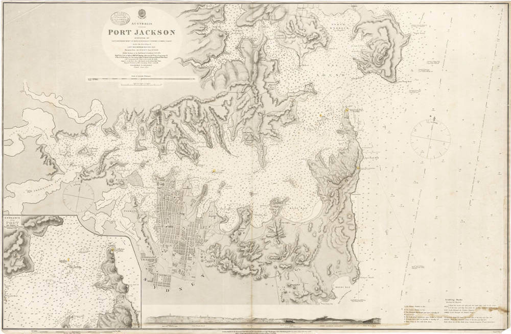
Australia - Port Jackson / Surveyed by Lieut. J. Hutchison etc ... 1857
Hydrographic Office
Price Three Shillings
With the oval shop stamp of "J. DONNE ADMIRALTY CHART AGENT And NAUTICAL BOOKSELLER 120 ELIZABETH ST MELBOURNE"
London Published at the Admiralty 11th Feb 1859 under the superintendence of Capt Washington R.N. F.R.S. Hydrographer.
Corrections June 1870. Dec 1872.
Engraved by J. & C. Walker
Very large and detailed navigation chart for Port Jackson (Sydney Harbour).
With a large scale inset chart of the entrance of the port in the lower left, as well as a profile view of the entrance along the bottom of the chart.
The chart has many soundings in fathoms, as well as magnetic bearings.
Condition
No restorations or meaningful imperfections. Very authentic look and feel. Clear signs of use, overall in excellent condition.