Leen Helmink Antique Maps & Atlases
www.helmink.com
Carey
A New and Accurate Map of New South Wales with Norfolk and Lord Howes Islands ...
Certificate of Authentication and Description
This is to certify that the item illustrated and described below is a genuine antique
map, print or book that was first produced and published in 1814, today 212 years ago.
April 17, 2026
Cartographer(s)
Carey
First Published
Philadelphia, 1814
This edition
1814 first edition
Size
cms
Technique
Stock number
19515
Condition
excellent
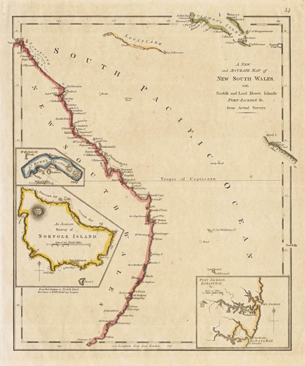
Description
Early map of coastal regions of New South Wales, with insets of the Port Jackson area, Lord Howe's Island and Norfolk Island.
Matthew Carey's close copy of Robert Wilkinson's 1794 map of the same, but without his London address below the lower border.
From: Carey's General Atlas, Improved And Enlarged; Being A Collection Of Maps Of The World And Quarters, Their Principal Empires, Kingdoms, &c. ... Philadelphia: Published By M. Carey. 1814. T.S. Manning, Printer, N.W. Corner of Sixth & Chestnut Streets.
The first atlas made in the United States to employ standard color on the maps; while the Carey 1795 American Atlas and the Carey 1811 General Atlas list color as an option on the title page, we have never seen any copies of a pre 1814 Carey atlas with original color - they may exist, but would be rare - color was first employed as standard in this 1814 edition.