Leen Helmink Antique Maps & Atlases
www.helmink.com
Pierre Du Val
CANADA
Certificate of Authentication and Description
This is to certify that the item illustrated and described below is a genuine antique
map, print or book that was first produced and published in 1660, today 366 years ago.
July 21, 2026
Cartographer(s)
Pierre Du Val
First Published
Paris, 1660
This edition
Paris, 1661
Size
10.0 x 12.0 cms
Technique
Copper engraving
Stock number
18737
Condition
excellent
Description
State 2 of 4, issued in 1661.
Condition
Thick paper, wide margins. Attractive original colour, applied by the oublishing house. An excellent collector's example.
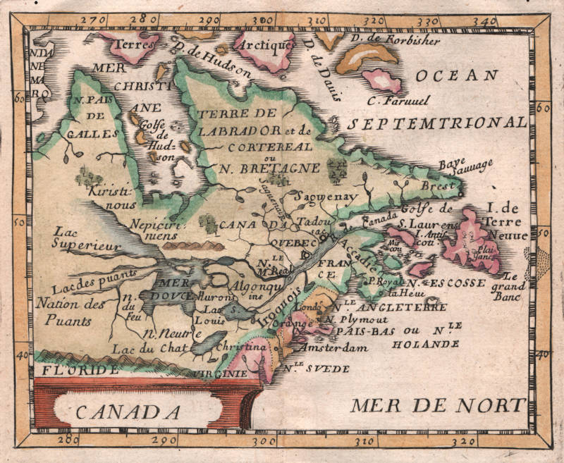
Pierre Duval, CANADA, Paris, 1660
Copperplate engraving, 100 x 120 mm.
From: Le Monde Terrestre
This is one of a number of North American related maps in Pierre Duval's modest Le Monde Terrestre. It is derived from his uncle, Nicolas Sanson’s, Le Canada, 1656. Even including the familiar sea route through the north-west of Hudson Bay. The author has identified four states of the map. There is a later derivative published in Nuremberg, 1678, by Beer:
State 1 1660
Identified by the lack of any tribal names in the west
State 2 1661 [this state here]
Tribal names added in the west
State 3 1672
Mer de Canada added above MER DE NORT. Many new names introduced including 3.Rivieres, al=Manhate appended to Amsterdam and Boston al= to Londo. The Chesapeake is named and a church symbol is added to Quebec
State 4 c.1687
The plate number 8 is added in the lower right corner
Duval 1660
Bears MER DE NORT
Beer 1678
Bears MARE DEL NORT
(Philip Burden, The Mapping of North America, map 351)
Pierre Du Val (c.1619-1683)
Pierre Du Val was one of the most influential French mapmakers of the third quarter of the seventeenth century. He was the son-in-law and apprentice of Nicolas Sanson, the foremost French mapmaker of the period. From 1650, he was the official royal Geographer to the King of France Louis XIV, who had encouraged him to move to Paris. He published a wide range of atlases, individual maps of the world and the continents, as well as wall maps. His work was of great significance.