Leen Helmink Antique Maps & Atlases
www.helmink.com
Visscher
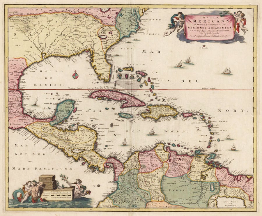
Insulae Americanae, in Oceano Septentrionali ac Regiones Adiacentes, ..
Certificate of Authentication and Description
This is to certify that the item illustrated and described below is a genuine antique
map, print or book that was first produced and published in 1680, today 346 years ago.
February 13, 2026
Cartographer(s)
Visscher
First Published
Amsterdam, 1680
This edition
1680
Size
46 x 56 cms
Technique
Copper engraving
Stock number
17997
Condition
mint


Description
Famous and handsome map of the Caribbean by Nicolaas Visser II.
"A beautifully engraved map of the Caribbean. It is nicely embellished with a very decorative title cartouche that is supported by cupids and the scale cartouche is supported by Mermaids and a Merman. The map extends from Cape May, New Jersey to the Equator and Embraces the whole of the Gulf of Mexico, Central America, the West Indies and part of South America."
(Harry Newman)
"Nicolaas Visscher II inherited the shop of his father of the same name upon his death in 1679. The following year he married Elizabeth Verseyl of Gouda. In 1682 he applied to the States of Holland and West Friesland for a patent for printing and publishing maps, it was granted the same year. He promptly printed a catalogue of his maps. A comparison with his father's earlier catalogue dating from no later than 1677 illustrates a large number of new maps. One may speculate that these were largely at the hand of the son. Certainly this map centred on the West Indies is one that we could quite confidently date to c.1680 as it lacks a privilege granted in 1682.
It is derived from the long lineage of maps that began with the Hessel Gerritsz sea chart of c.1631. Of all those before no other embraced interior detail. Cartographically it is not so innovative utilising older Dutch geography. No mention is made, for instance, of the English presence in Carolina. Two baroque cartouches adorn opposite corners enclosing the title and the scale of miles. The map appeared in Visscher atlases entitled Atlas Minor. Those called the Atlas Contractus are generally accepted to be by Nicolaas Visscher I. Both Visscher atlases are largely composite in nature, that is their contents vary, the Atlas Minor averaging around 100 maps. Visscher's privilege was renewed in 1697. In 1702 he died and the business was continued with some considerable vigour by his widow Elizabeth, who maintained the Atlas Minor. One atlas survives with the title of Atlas Major. With her death in 1726 the famous firm begun by Claes Jansz. Visscher sometime before 1608, passed out of the family and into the hands of Andries de Leth. Many of the plates were disposed of to Petrus Schenk II, at a date that is unknown, possibly before the death of Elizabeth, but anter the death of Schenk's father c.1718/19. The map appears in examples of his Atlas Contractus, which is similarly undated and composite in nature, until c.1740. The map has also been located in examples of atlases by Frederick de Wit, the heirs of Janssonius, Abraham Wolfgang, Carol Allard and the Ottens family."
(Burden)
Claes Janszoon Visscher 1587-1652
Nicolaes Visscher I (son) 1618-1679
Nicolaes Visscher II (grandson) 1649-1702
Elisabeth Visscher (widow of N. Visscher II)
"For nearly a century the members of the Visscher family were important art dealers and map publishers in Amsterdam. The founder of the business, Claes Janszoon Visscher, had premises near to those of Pieter van den Keere and Jodocus Hondius whose pupil he may have been.
From about 1620 he designed a number of individual maps, including one of the British Isles, but his first atlas consisted of maps printed from plates bought from van den Keere and issued as they stood with some additions of his own, including historical scenes of battles and sieges for which he had a high reputation.
Some maps bear the latinized form of the family name: Piscator. After Visscher's death his son and grandson, both of the same name, issued a considerable number of atlases, constantly revised and brought up to date but most of them lacking an index and with varying contents.
The widow of Nicholaes Visscher II carried on the business until it finally passed into the hands of Pieter Schenk."
(Moreland & Bannister).